January · water everywhere
The shutoff valve, under snow
A pipe lets go at 6pm. The main shutoff is somewhere under four hundred square feet of white. Every minute of guessing is water in the wall.
Artifact Tracker · offline GPS field marker
The shutoff valve, the trail cam, the property pin, the thing you buried on purpose — you knew exactly where it was eight months ago. Mark it once with re-averaged GPS, a note and a photo of the spot, and the compass walks you back to it. Offline. Yours from $29.
No account · No signal needed · No cloud · Not $99/month
You already know this feeling
January · water everywhere
A pipe lets go at 6pm. The main shutoff is somewhere under four hundred square feet of white. Every minute of guessing is water in the wall.
Camera pull · end of season
Cameras get moved all season. Come pull time, you're re-walking every ridge line trying to remember which tree — and some stay out there.
Fence quote · property dispute
The surveyor found it once — that cost you real money. The flag is long gone, and the neighbor is confident about your fence line.
Fall blowout · spring startup
Heads bury themselves under thatch and landscaping. You end up paying someone by the hour while you both stomp around looking.
"I was surprised several times by finding cameras on trees that I'd forgotten about." — hunter, DeerBuilder forum, "Keeping track of all your trail cameras"
"I keep a spreadsheet on my laptop, that I use to track the locations of my trail cameras." — the current state of the art, same thread
The price of not knowing
Every line here is a bill somebody paid because a location wasn't written down. You don't need any of them — you were standing on the exact spot, once.
Honest about the hard part
A single GPS snapshot can be off by 10–30 feet — anyone who says otherwise is selling you something. Artifact Tracker is built around that truth: average the fix, keep a human note and a photo, let the compass do the last stretch.
Tracker re-averages GPS readings while you stand on the spot, and saves a relative note with every mark — "11 ft NE of the maple." Snap a photo of the spot, tag it, done in 20 seconds.
GPS·AVG + relative note + category + photo
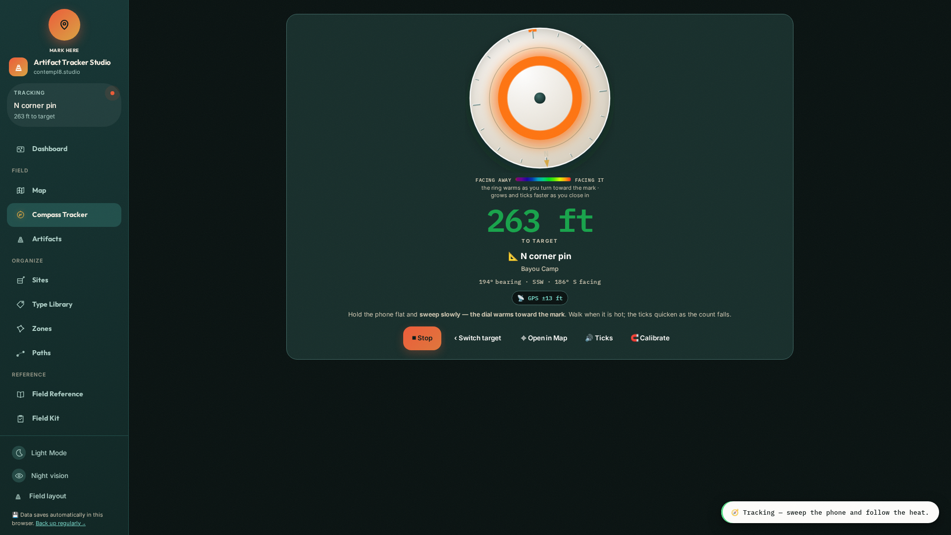
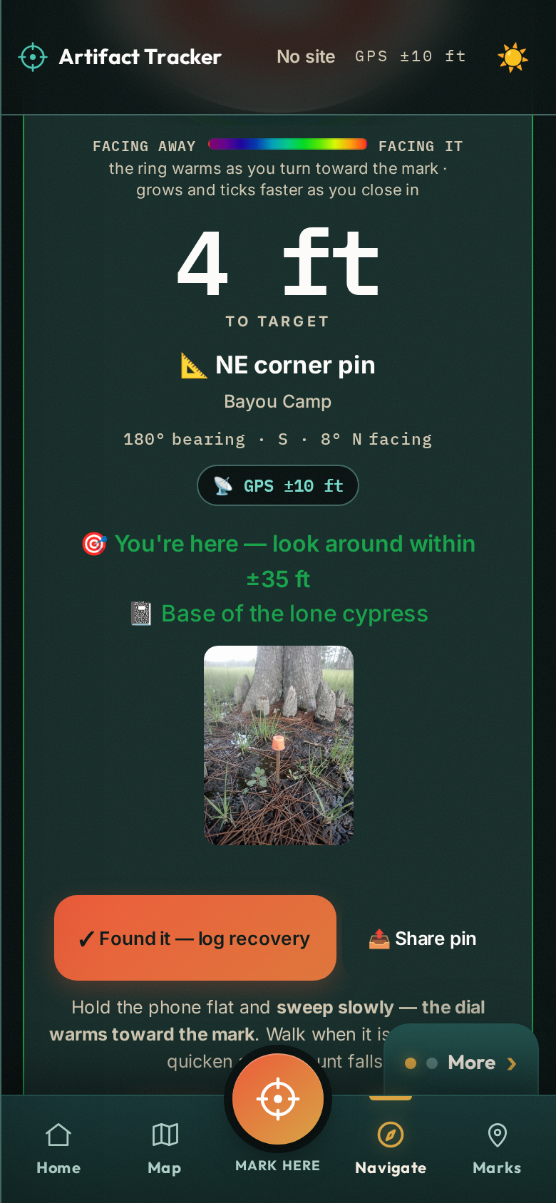
Next season, open the mark. A live compass and distance readout walk you across the field — 87 ft, 40, 12 — and when you arrive, the photo you took and your note are right there on screen to finish the last few feet.
Live heading + distance + your photo + your words
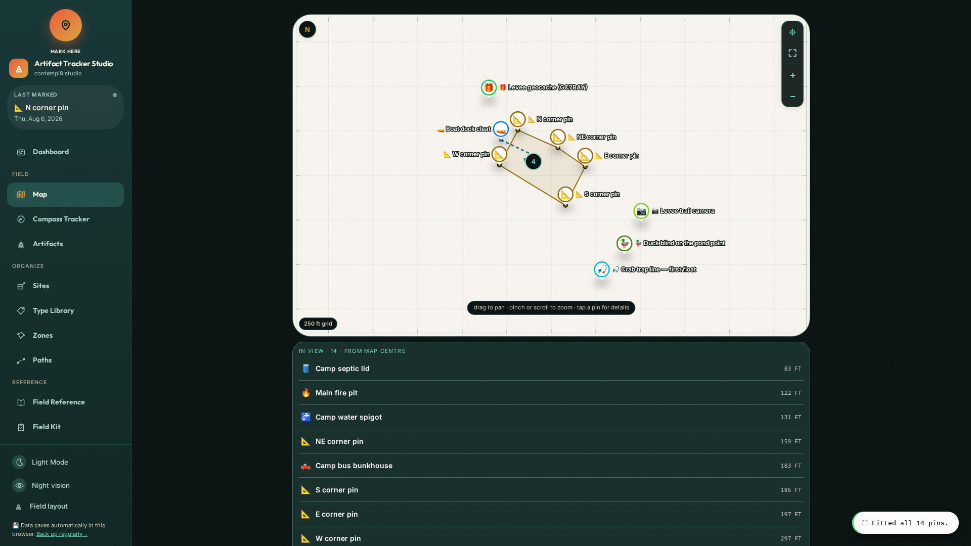
One offline file on your device. No account, no cloud, no subscription. Draw zones, organize by property, and export GPX · KML · GeoJSON · CSV any time — it works in every mapping tool on earth.
Offline file · GPX/KML in and out · multi-property
"In the best scenario, you will get an accuracy of 10 to 15 feet, but obstruction can add that number up to 30 feet or more." — SNAP! Geocaching, "Why are my coordinates so far off?" — the drift every mark here is built to survive
Not a mockup
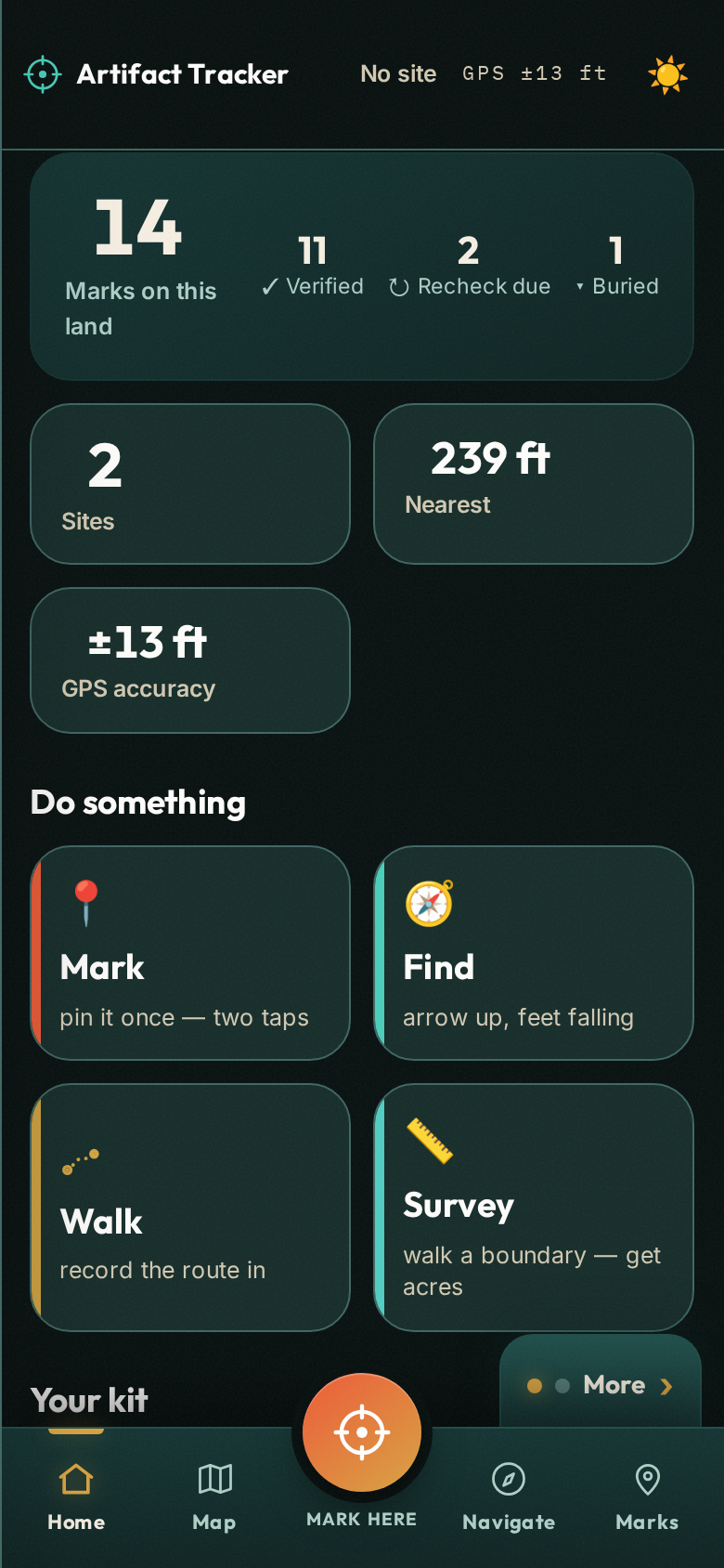
Real screens, straight from the working tool — the same one in the free demo, so you can hold it before you buy it.
No lock-in — filmed, not promised
One uncut take, start to finish: back up everything with one tap, then hand your marks to any map program on earth. Watch a real export come alive in geojson.io — pins, zone, field notes, all of it.
GPX → Garmin · Gaia · onX · Caltopo KML → Google Earth GeoJSON → QGIS · Mapbox CSV → any spreadsheet
The arrows run both ways. Coming from Garmin, onX, Gaia or Google Earth? Import your GPX, KML or GeoJSON and bring every mark with you — waypoints become marks, tracks and boundaries become zones, and you see a preview before a single thing is saved.
One tool, every buried thing
"Tap a location anywhere on the map to add your own Waypoints for campsites, rock crawl areas, non-ethanol fuel stations or where you parked the trailer." — from a subscription offroad-mapping app's own feature list. Even they know this pain — they just charge for it every year.
It's your land, not a coverage map. Everything runs on-device — mark and walk back with no signal at all.
These are the coordinates of everything you own — and a few things only you know about. They never leave your phone. That's a security decision, not a feature gap.
Open the file, use the tool. Nothing to sign into, nothing to expire, nothing to get breached.
The file is yours like a hammer is yours. No renewal email will ever charge you for access to your own property.
Before your card comes out
▲ 0 ft — you're standing on it
$99/month elsewhere from $29 · once Comparable apps charge $99+ every month and keep your locations in their cloud. This is the other philosophy: Solo and Homestead you buy once and own outright; Crew is an annual license sized for outfits — and either way every coordinate stays on your own devices.
$29 once
$39 once
$299 /yr
Ten seats or more? Email [email protected] for an invoice.
| Side by side | Solo | Homestead | Crew Annual |
|---|---|---|---|
| Price | $29 once | $39 once | $299/yr · first 20 outfits $199/yr |
| Sites | 1 | Unlimited | Unlimited |
| Seats — a seat is a phone or computer | Your phone + computer | Your phone + computer | Five · add seats $49/yr each |
| Marks, zones & photos | Unlimited | Unlimited | Unlimited |
| Exports — GPX · KML · GeoJSON · CSV | ✓ | ✓ | ✓ |
| Offline · no account · no cloud | ✓ | ✓ | ✓ |
| Branded reports — your logo on every printout | — | — | ✓ |
| Invoice & Payment Tracker | — | — | ✓ |
| Payment | Once, yours to keep | Once, yours to keep | Annual · devices keep working if it lapses |
Secure checkout by Stripe · Solo & Homestead: one payment, yours to keep · Crew: annual license for outfits · No account, ever · Try the full tool free first, because sales are final
Works on phone & computer · Call 811 before you dig near any utility
Sold by AMZE LLC under the terms · privacy · email a question before you buy